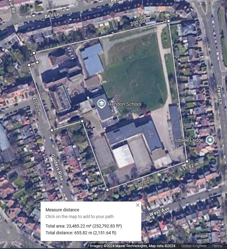
These images show the disproportionate take of land by the application, with comparison to pupil numbers at nearby schools – of similar pupil capacity.
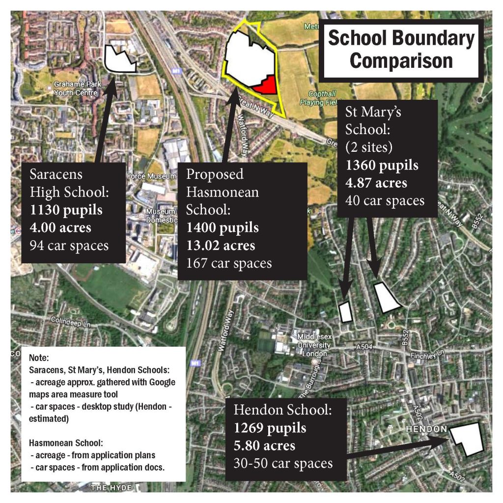
Pupil Capacity for each school found here:
Saracens High School:
https://www.get-information-schools.service.gov.uk/Establishments/Establishment/Details/145921
Hendon School:
https://www.get-information-schools.service.gov.uk/Establishments/Establishment/Details/137645
St Mary’s School:
https://www.get-information-schools.service.gov.uk/Establishments/Establishment/Details/103119
– St Mary’s pupil numbers are less St Johns Infants (180) and Junior (240):
– https://www.get-information-schools.service.gov.uk/Establishments/Establishment/Details/101320
– https://www.get-information-schools.service.gov.uk/Establishments/Establishment/Details/101322
And the workings:
1) a check file below to corroborate the accuracy of the Google Maps measurement tool used, with the planning application documents and the hectares/acreage given, this measures as
1) the google maps measure the ‘Planning Application Boundary’ as 21.47 acres
2) the submitted planning documents stated area is 21.42 acres
so the measuring tool is reasonably accurate.
The Hectares to Acres conversion formula is:
Acres = Hectares * 2.47105
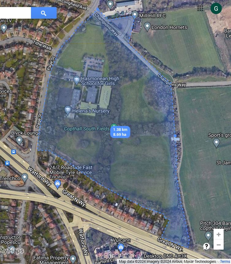
Saracens High School, Graham Park, which opened in 2018, just across the road in Graham Park:
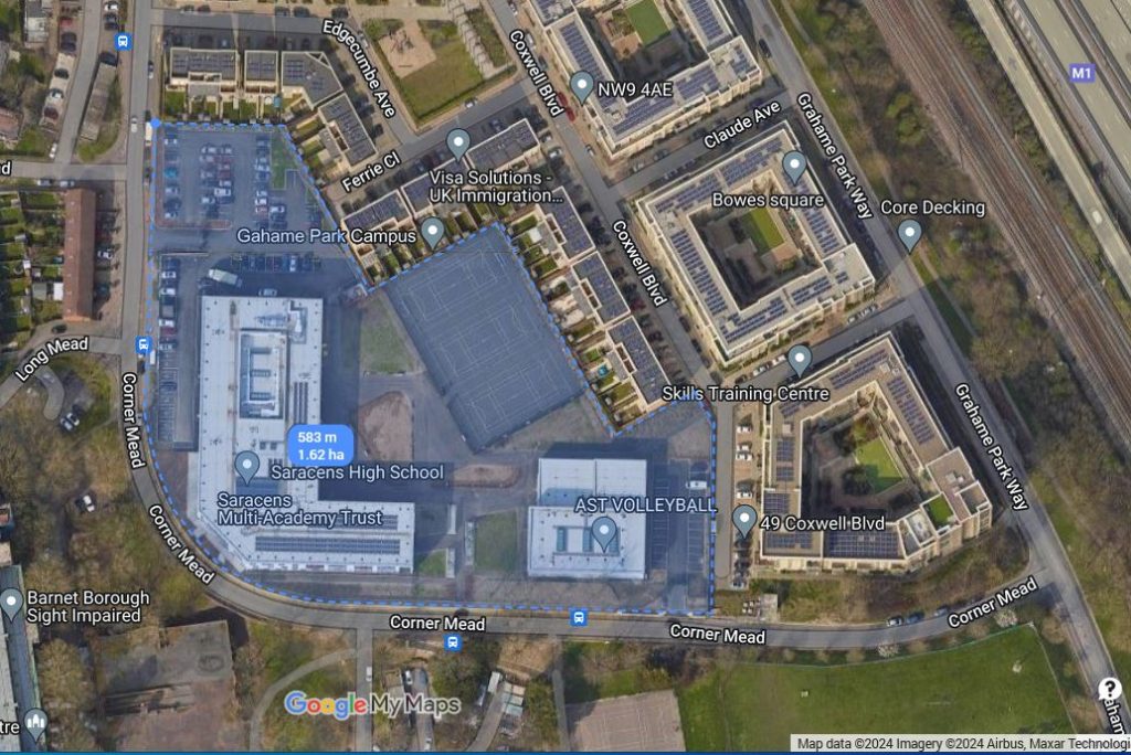
Hendon School: (1 Square Meter ≈ 0.00024710538 Acres)
